After hearing so many stories about Posidonia and its importance for the sea and for us, you’ve probably wondered at some point – how do we actually know how much of it there is? Does someone count every single leaf? And how do we even know what we’re looking at when we dive?
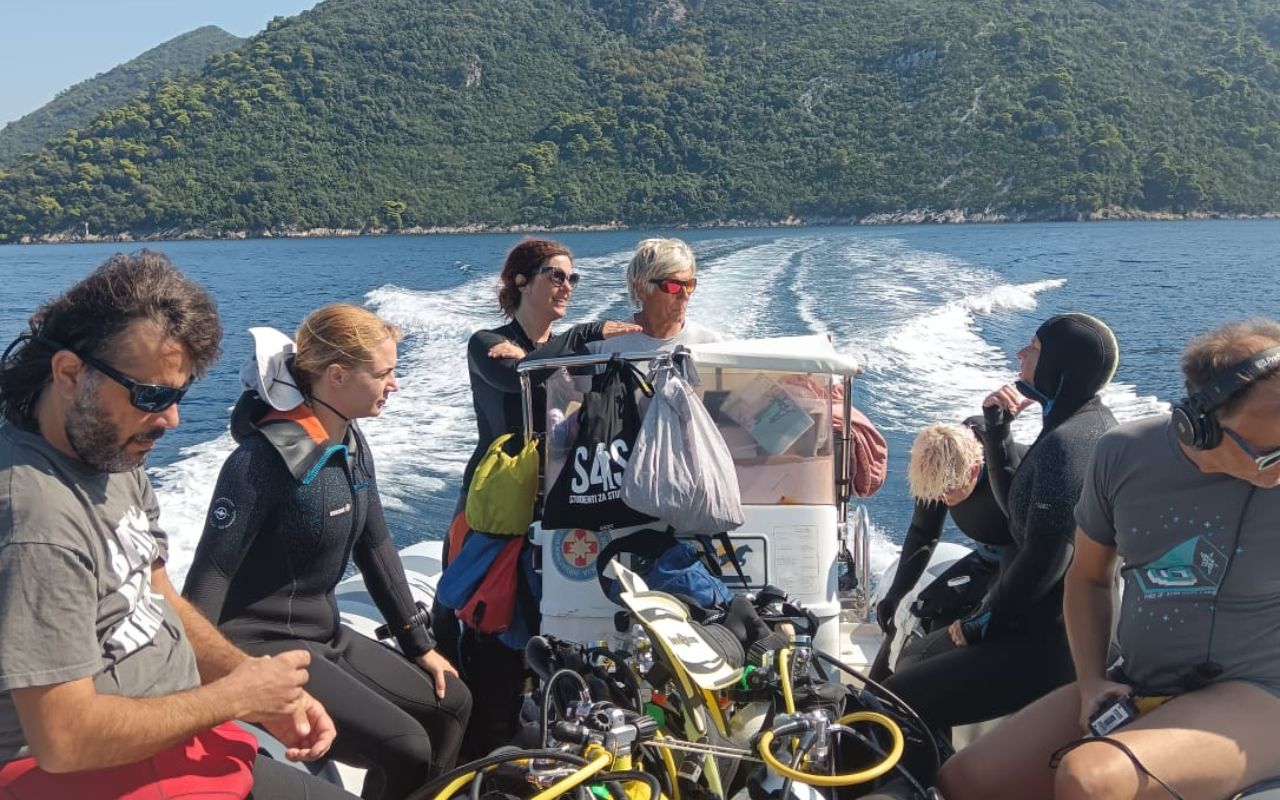
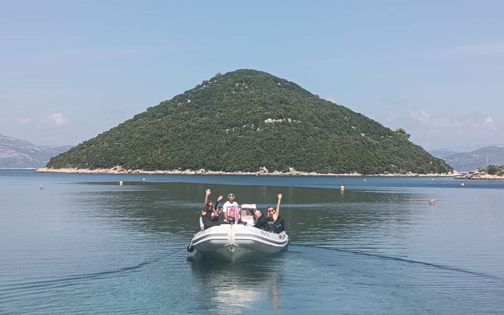
These questions were answered by the diving team from Sunce on May 21 and 22 this year during a training session for Posidonia monitoring at Kašuni beach in Split.
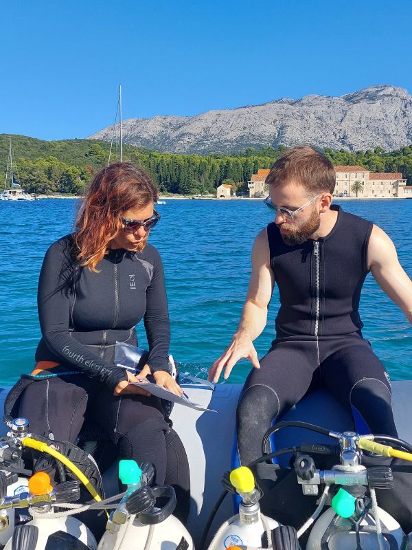
– For those of us who have feared ‘sea grass’ since childhood, monitoring Posidonia was a big step out of our comfort zone, but we knew we were there for a higher purpose. Through monitoring, we gain insight into shoot density and seabed coverage of this seagrass – two key factors that reveal its condition. Years of anchoring in the Adriatic have significantly damaged Posidonia meadows, so it’s essential to identify meadow areas and assess their conservation status to enhance protection of these habitats, – explained Tonka Dujmović, a second-year Master’s student in Marine Fisheries at the University Department of Marine Studies, who shared her diving experience as part of her internship at Sunce.
Diving with a higher purpose
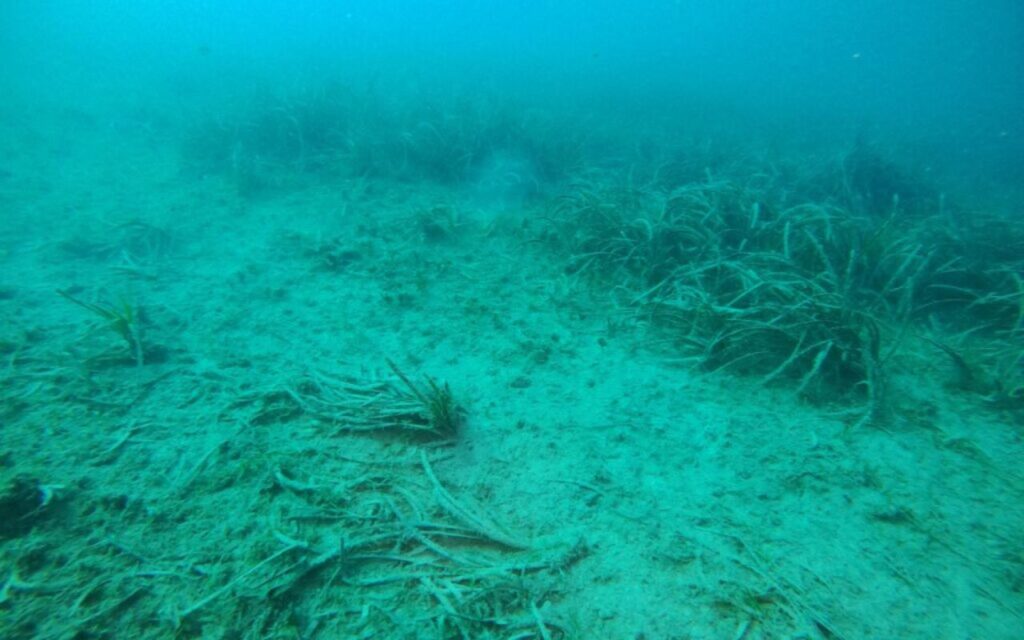
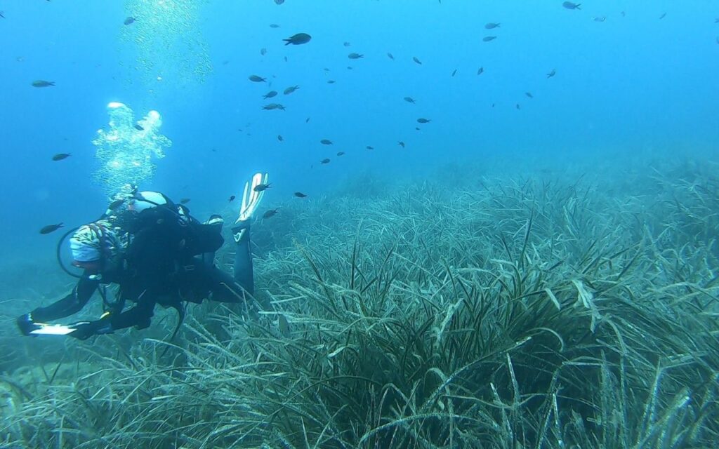
In Posidonia monitoring, divers count shoots, the clusters from which leaf blades grow, with each cluster representing a single “plant” in the vast underwater meadow. They also measure seabed coverage. This is done using simple but highly effective methods: the quadrat and transect techniques.
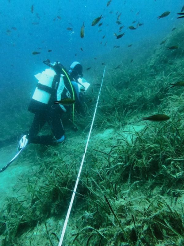
– Diving is done in pairs, and each diver has a specific task. One diver randomly places a 40 × 40 cm quadrat on the meadow, lies among the grass, and slowly counts the shoots. This is repeated eight times at each site to gather data on meadow density. Meanwhile, the other diver lays a 10-meter transect tape along the seabed, recording what lies beneath it: Posidonia, sand, rocks, dead shoots and roots, or something else entirely, – Tonka explained.
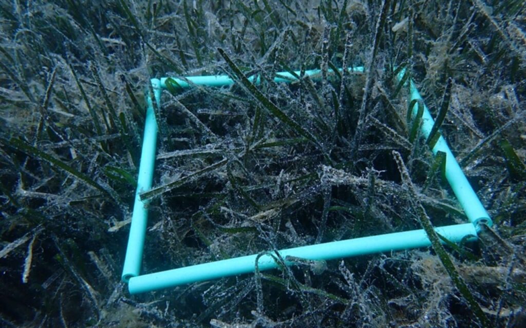
At the end, combining the data from eight quadrats and four transects per location provides a clear and invaluable picture of meadow density and overall condition.
A particularly enjoyable part of the process is the subtle underwater communication, using pencil and slate to record shoot counts, coverage, depth, and seabed characteristics.
– Every shoot counted, every meter of transect, and every note recorded underwater is a small but meaningful contribution to protecting Posidonia and maintaining balance in our blue ecosystem. Yet even though I know I’m contributing to the protection of the queen of the sea, I must admit I still dislike swimming when it’s ‘dark’ below me. But that doesn’t mean I won’t pay attention to where I anchor, – Tonka said with a smile.

A summer in Sunce meant only one thing – Posidonia monitoring
This May training was extremely valuable for Tonka and other new divers joining Sunce’s diving team, as June and September were filled with numerous field missions. The knowledge gained in training was quickly put into practice, and theory proved its worth under real underwater conditions.
This summer, as part of the BIOPRESSADRIA project, the team participated in two field studies: in Kornati National Park and within the ecological network HR4000007 Badija and the islands around Korčula. The Badija site stood out as one of the most poorly preserved Posidonia meadows in the southern Adriatic, highlighting the importance of monitoring and continuous observation of this extremely sensitive habitat.
In addition to these locations, monitoring was conducted in Telašćica Nature Park, the waters of Mljet National Park, and the ecological network area POVS HR3000166, spanning the northern coast from Punta Pusta in Sobra Bay to Punta Stoba near Okuklje Bay, including nearby islands and waters.
Karla Jelić, an Assistant at Nature Conservation Department at Sunce, who has been diving with the team for a year, described a typical day on the field.
Field experience: ‘Every dive brings a new lesson’
Every day starts with preparing gear, checking tanks, boarding the boat, and sailing to the designated site. Sometimes the sea is calm as a mirror, other times waves and wind remind us that the dive will be more challenging than planned.
– Upon arrival, we use GPS to precisely locate the points where we place diving buoys, our reference markers for underwater work. After a brief discussion and final task check, we dive and it is the moment when the noise of the world stays above the surface, and a quiet, blue dimension opens before us, – Jelić says.
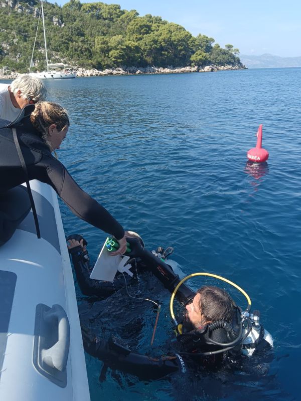
Underwater, the real work begins. Divers carefully lay the transect tape, while their partners place quadrats and count Posidonia shoots with concentration and patience.
– Strong currents, reduced visibility, or unexpected weather changes sometimes surprise us, but these moments give authenticity to the fieldwork and remind us that we are guests in this delicate underwater world. Every dive brings a new lesson: about Posidonia, the sea, or even ourselves, – Jelić noted.
Back on the boat, after peeling off wet suits and taking the first sips of water, divers exchange impressions and analyze collected data.
– As the sun slowly sets, there’s a quiet realization that another small piece of the mosaic depicting our sea’s condition has been recorded. From the first glance, and later through data analysis, the difference between sites with frequent anchoring and those without becomes clear. Anchored areas show fragmented, thinned meadows, while untouched sites retain denser, more continuous, and stable Posidonia structures. The contrast underscores the profound impact human activity has on the marine ecosystem, – Jelić explained.
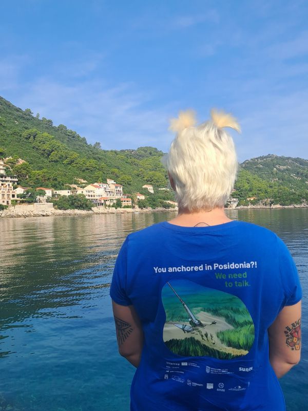
And where do you anchor?
Monitoring results clearly show that anchoring is one of the primary pressures on Posidonia meadows. Without stricter regulations and management measures, irreversible loss of meadows could occur at the most heavily impacted sites in the coming years. That’s why it’s crucial to continually ask boaters: And where do you anchor? because only when they realize they are anchoring in a strictly protected species and threatening underwater life can their behavior start to change.

In addition to physical damage, invasive species are increasingly present, particularly Caulerpa cylindracea, which in some areas has nearly taken over.
Although monitoring may seem like a rather romantic job, it’s important to recognize your own limits.
– The weightless feeling underwater is incredible, but there are days when the numbers blur, concentration falters, and climbing back onto the boat feels like science fiction. In those moments, it’s crucial to stop and take a break. Ego can get in a diver’s way, but that’s when the biggest mistakes happen. For this reason, it’s essential to know your limits and stop when you don’t feel well. And yes, there have been such days. In nature conservation, we must protect ourselves first, – warns Dujmović.
These field missions once again confirmed the importance of systematic, long-term data collection. Such data not only documents current conditions but also forms the foundation for decisions that ensure more effective protection and sustainable management of one of our region’s most valuable marine flowering plants.
Cover photo by: Barbara Matejčić
